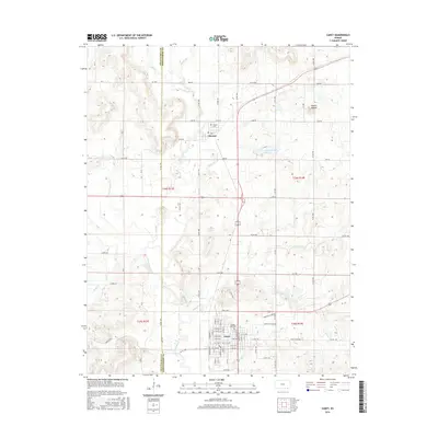
2016 Map of Caney
USGS Topo · Published 2016About this map
The Little Caney River and its numerous tributaries, including Cheyenne Cr and Cotton Cr, define the drainage patterns of this Montgomery County landscape. Near the southern border, the city of Caney is laid out in a traditional grid, featuring Sunny Side Cem on its northern edge. Further north, the smaller settlement of Havana is situated near its namesake Havana Cem and the waters of Havana Lake. The terrain is characterized by a series of low ridges and creeks, notably marked by the prominent Round Mound in the northeastern section. This 2016 survey illustrates the modern road network, where rural routes like Co Rd 1900 and Co Rd 1500 connect these agricultural communities across the county line from Chautauqua County.
Find a feature on this map
119 named features on this map. Tap any name to fly to it.
Don’t see what you’re looking for? This feature index may not catch every label — zoom into the map to look around manually.
Map Details
Editions of this 2016 Caney Map
This is the sole edition of this map. No revisions or reprints were ever made.
Other maps of this area

1885 · Sedan
USGS Topo · 1:125,000

1886 · Independence
USGS Topo · 1:125,000

1889 · Sedan
USGS Topo · 1:125,000

1894 · Independence
USGS Topo · 1:125,000

1901 · Nowata
USGS Topo · 1:125,000

1905 · Independence
USGS Topo · 1:125,000

1909 · Pawhuska
USGS Topo · 1:125,000

1910 · Pawhuska
USGS Topo · 1:125,000

1914 · Nowata
USGS Topo · 1:125,000

1947 · Joplin
USGS Topo · 1:250,000