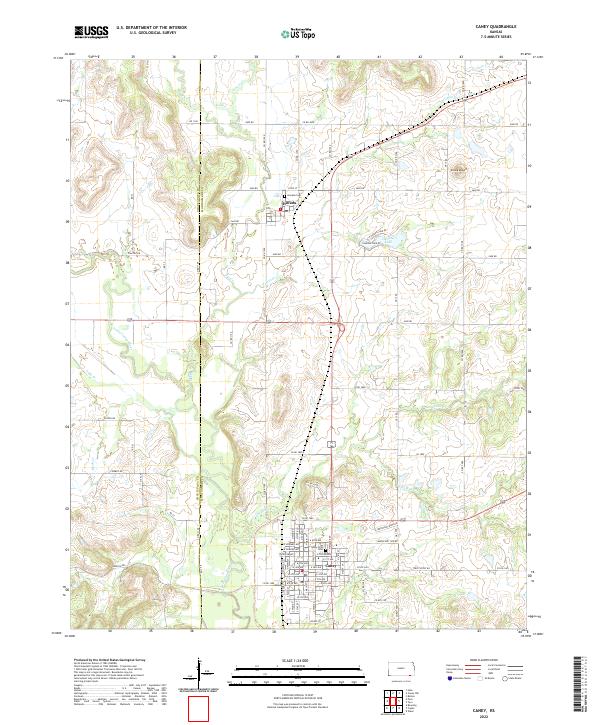
2022 Map of Caney
USGS Topo · Published 2022About this map
Caney anchors the southern edge of this Montgomery County landscape, where the confluence of Mud Cr and the Little Caney River dictates the local geography. The grid of the town is well-established, featuring Sunny Side Cem on the northern outskirts and an Industrial Park Rd sector that hints at the area's modern commercial development. To the north, the smaller settlement of Havana is situated near Havana Cem, positioned within a network of county roads like Co RD 1300 and Co RD 1500.
Find a feature on this map
86 named features on this map. Tap any name to fly to it.
Don’t see what you’re looking for? This feature index may not catch every label — zoom into the map to look around manually.
Map Details
Editions of this 2022 Caney Map
This is the sole edition of this map. No revisions or reprints were ever made.
Other maps of this area

1885 · Sedan
USGS Topo · 1:125,000

1886 · Independence
USGS Topo · 1:125,000

1889 · Sedan
USGS Topo · 1:125,000

1894 · Independence
USGS Topo · 1:125,000

1901 · Nowata
USGS Topo · 1:125,000

1905 · Independence
USGS Topo · 1:125,000

1909 · Pawhuska
USGS Topo · 1:125,000

1910 · Pawhuska
USGS Topo · 1:125,000

1914 · Nowata
USGS Topo · 1:125,000

1947 · Joplin
USGS Topo · 1:250,000