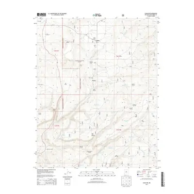
2013 Map of Canjilon
USGS Topo · Published 2013About this map
Canjilon sits at the heart of this high-elevation landscape within the Carson National Forest, where the mountain terrain is defined by a complex network of canyons and mesas. The settlement pattern is closely tied to the water of Canjilon Cr, with nearby Placitas and Llanito de la Cruz illustrating the historic communal land use of the region. Local heritage is preserved at sites like the Canjilon Cem and Cedar Grove Cem, while the Canjilon District Ranger Office reflects the long-standing federal management of these timber and grazing lands. The map reveals an extensive system of water management for livestock, evidenced by numerous tanks such as Trick Tank Number Two and Garcia Tank, scattered between prominent landmarks like Mesa del Medio and Mesa Juan Domingo.
Find a feature on this map
56 named features on this map. Tap any name to fly to it.
Don’t see what you’re looking for? This feature index may not catch every label — zoom into the map to look around manually.
Map Details
Editions of this 2013 Canjilon Map
This is the sole edition of this map. No revisions or reprints were ever made.
Other maps of this area

1909 · Gallina
USGS Topo · 1:125,000

1918 · Abiquiu
USGS Topo · 1:125,000

1918 · Tusas
USGS Topo · 1:125,000

1953 · Alire
USGS Topo · 1:24,000

1953 · Echo Ampitheater
USGS Topo · 1:24,000

1953 · Magote Peak
USGS Topo · 1:24,000

1953 · Canjilon
USGS Topo · 1:24,000

1953 · Canjilon SE
USGS Topo · 1:24,000

1953 · Ghost Ranch
USGS Topo · 1:24,000

1954 · Aztec
USGS Topo · 1:250,000