
1953 Map of Echo Ampitheater
USGS Topo · Published 1955About this map
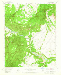
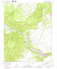
Echo Amphitheater sits at the heart of this landscape, where the high cliffs of the Mesa de los Viejos meet the open flats of the Piedra Lumbre Grant. This 1953 field-checked survey reveals a region defined by its Spanish land grant heritage and the managed wilderness of the Carson National Forest and Santa Fe National Forest. The Rio Chama flows through the center of the sheet, carving a path between the Llano del Vado and the rising slopes of Mesa Alta. Local land use is marked by sparse but critical infrastructure, including the Burns Ranch and a remote Windmill located near the Chama Grant Boundary. The mapping also traces the deep drainage of Joaquin Canyon and Arroyo Seco, illustrating the complex network of arroyos and cañadas that funnel into the river valley.
Find a feature on this map
17 named features on this map. Tap any name to fly to it.
Don’t see what you’re looking for? This feature index may not catch every label — zoom into the map to look around manually.
Map Details
Editions of this 1953 Echo Ampitheater Map
3 editions found
Other maps of this area

1909 · Gallina
USGS Topo · 1:125,000

1918 · Abiquiu
USGS Topo · 1:125,000

1953 · Canones
USGS Topo · 1:24,000

1953 · Alire
USGS Topo · 1:24,000

1953 · Arroyo Del Agua
USGS Topo · 1:24,000

1953 · Canjilon
USGS Topo · 1:24,000

1953 · Laguna Peak
USGS Topo · 1:24,000

1953 · Navajo Peak
USGS Topo · 1:24,000

1953 · Youngsville
USGS Topo · 1:24,000

1953 · Ghost Ranch
USGS Topo · 1:24,000