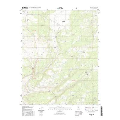
2017 Map of Canjilon
USGS Topo · Published 2017About this map
Canjilon and the smaller settlement of Placitas sit at the center of this 2017 survey, surrounded by the diverse terrain of the Carson National Forest. The landscape is defined by high mesas and deep canyons, including Mesa Juan Domingo and the prominent La Mesita. This era of mapping shows a high concentration of water management features, notably numerous named tanks such as Trick Tank Number Six, Garcia Tank, and Cruz Number One Tank, illustrating the vital importance of water storage in this high-elevation environment. Genealogy and local history researchers can identify the locations of Cedar Grove Cem and the Canjilon Cem. The winding route of the Continental Divide National Scenic Trail traverses the southern half of the map, cutting through Piedra Lumbre Canyon and crossing Mesa Montosa.
Find a feature on this map
54 named features on this map. Tap any name to fly to it.
Don’t see what you’re looking for? This feature index may not catch every label — zoom into the map to look around manually.
Map Details
Editions of this 2017 Canjilon Map
This is the sole edition of this map. No revisions or reprints were ever made.
Other maps of this area

1909 · Gallina
USGS Topo · 1:125,000

1918 · Abiquiu
USGS Topo · 1:125,000

1918 · Tusas
USGS Topo · 1:125,000

1953 · Alire
USGS Topo · 1:24,000

1953 · Echo Ampitheater
USGS Topo · 1:24,000

1953 · Magote Peak
USGS Topo · 1:24,000

1953 · Canjilon
USGS Topo · 1:24,000

1953 · Canjilon SE
USGS Topo · 1:24,000

1953 · Ghost Ranch
USGS Topo · 1:24,000

1954 · Aztec
USGS Topo · 1:250,000