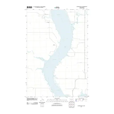
2011 Map of Cannon Ball SE
USGS Topo · Published 2011About this map
The Missouri River dominates this stretch of the Cannonball District, where the wide alluvial plains of the Kenel Flats meet the western shoreline. Several historic burial sites, including Saint James Cemetery, Old Catholic Cemetery, and Big Lake Cemetery, are situated along the bluffs and plateaus overlooking the water, providing significant points of interest for genealogical research in this part of Sioux County. The landscape is defined by the convergence of several drainages with the Missouri, such as Horsehead Creek to the north and the winding paths of Beaver Holes Creek and Fool Bear Creek to the west. This 2011 survey documents a sparsely settled region primarily organized by a grid of rural routes like 73rd St SW and 77th Ave SW, reflecting the enduring agricultural and ranching character of the land along the North Dakota and South Dakota border region.
Find a feature on this map
14 named features on this map. Tap any name to fly to it.
Don’t see what you’re looking for? This feature index may not catch every label — zoom into the map to look around manually.
Map Details
Editions of this 2011 Cannon Ball SE Map
This is the sole edition of this map. No revisions or reprints were ever made.
Other maps of this area

1954 · Bismarck
USGS Topo · 1:250,000

1958 · Bismarck
USGS Topo · 1:250,000

1968 · Cannon Ball
USGS Topo · 1:24,000

1968 · Cannon Ball SE
USGS Topo · 1:24,000

1968 · Fort Yates NW
USGS Topo · 1:24,000

1968 · Cannon Ball NW
USGS Topo · 1:24,000

1968 · Fort Yates NE
USGS Topo · 1:24,000

1968 · Cannon Ball SW
USGS Topo · 1:24,000

1971 · Grassna NW
USGS Topo · 1:24,000

1971 · Hazelton SW
USGS Topo · 1:24,000