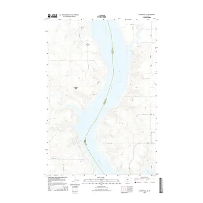
2014 Map of Cannon Ball SE
USGS Topo · Published 2014About this map
The Missouri River corridor defines this landscape along the boundary of Sioux and Emmons counties, where the river widens into Lake Oahe. On the western bluffs, the community of Cannon Ball is situated amidst a network of drainage ways including Beaver Holes Cr and Fool Bear Cr. This 2014 survey records several significant local landmarks for genealogists, including the Old Catholic Cem, Saint James Cem, and Big Lake Cem. The eastern shore is marked by the mouth of Horsehead Creek and the route of ND-1804, tracing the high ground above the reservoir. The map illustrates the transition from the rolling prairie uplands to the expansive water of the Missouri valley, capturing the placement of rural cemeteries and the road grid that serves this tribal district.
Find a feature on this map
28 named features on this map. Tap any name to fly to it.
Don’t see what you’re looking for? This feature index may not catch every label — zoom into the map to look around manually.
Map Details
Editions of this 2014 Cannon Ball SE Map
This is the sole edition of this map. No revisions or reprints were ever made.
Other maps of this area

1954 · Bismarck
USGS Topo · 1:250,000

1958 · Bismarck
USGS Topo · 1:250,000

1968 · Cannon Ball
USGS Topo · 1:24,000

1968 · Cannon Ball SE
USGS Topo · 1:24,000

1968 · Fort Yates NW
USGS Topo · 1:24,000

1968 · Cannon Ball NW
USGS Topo · 1:24,000

1968 · Fort Yates NE
USGS Topo · 1:24,000

1968 · Cannon Ball SW
USGS Topo · 1:24,000

1971 · Grassna NW
USGS Topo · 1:24,000

1971 · Hazelton SW
USGS Topo · 1:24,000