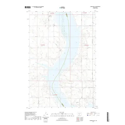
2017 Map of Cannon Ball SE
USGS Topo · Published 2017About this map
Saint James Episcopal Cem and the Old Catholic Cem sit on the high ground west of the Missouri River, marking the long-standing community foundations in this corner of Sioux County. This 2017 survey shows the landscape shaped by the waters of Lake Oahe, where the river's path defines the boundary with Emmons County. The drainage patterns of the northern plains are evident in the winding courses of Horsehead Creek to the east and Beaver Holes Cr and Fool-Bear Cr to the west. Local infrastructure is primarily oriented around the township and range grid, with routes like S Big Lake Rd and Big Lake Rd providing access to the Big Lake Cem and the surrounding agricultural tracts. The map records a sparsely populated region where geography is defined by river bluffs and the seasonal flow of prairie creeks.
Find a feature on this map
29 named features on this map. Tap any name to fly to it.
Don’t see what you’re looking for? This feature index may not catch every label — zoom into the map to look around manually.
Map Details
Editions of this 2017 Cannon Ball SE Map
This is the sole edition of this map. No revisions or reprints were ever made.
Other maps of this area

1954 · Bismarck
USGS Topo · 1:250,000

1958 · Bismarck
USGS Topo · 1:250,000

1968 · Cannon Ball
USGS Topo · 1:24,000

1968 · Cannon Ball SE
USGS Topo · 1:24,000

1968 · Fort Yates NW
USGS Topo · 1:24,000

1968 · Cannon Ball NW
USGS Topo · 1:24,000

1968 · Fort Yates NE
USGS Topo · 1:24,000

1968 · Cannon Ball SW
USGS Topo · 1:24,000

1971 · Grassna NW
USGS Topo · 1:24,000

1971 · Hazelton SW
USGS Topo · 1:24,000