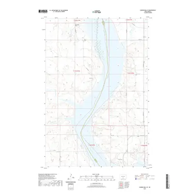
2020 Map of Cannon Ball SE
USGS Topo · Published 2020About this map
Lake Oahe and the Missouri River form a wide aquatic corridor through this part of the Standing Rock Reservation, dividing Sioux and Emmons counties. The western uplands are marked by numerous small drainages such as Beaver Holes Cr and Fool Bear Cr, which cut through the prairie landscape toward the river. This 2020 update provides critical details for genealogists, particularly the locations of several burial grounds situated on the western side of the river including Saint James Episcopal Cem, the Old Catholic Cem, and Big Lake Cem. The road network, including S Big Lake Rd and Bayside Dr, reflects the modern rural infrastructure and residential access points along the river's shoreline in this sparsely populated stretch of the Great Plains.
Find a feature on this map
29 named features on this map. Tap any name to fly to it.
Don’t see what you’re looking for? This feature index may not catch every label — zoom into the map to look around manually.
Map Details
Editions of this 2020 Cannon Ball SE Map
This is the sole edition of this map. No revisions or reprints were ever made.
Other maps of this area

1954 · Bismarck
USGS Topo · 1:250,000

1958 · Bismarck
USGS Topo · 1:250,000

1968 · Cannon Ball
USGS Topo · 1:24,000

1968 · Cannon Ball SE
USGS Topo · 1:24,000

1968 · Fort Yates NW
USGS Topo · 1:24,000

1968 · Cannon Ball NW
USGS Topo · 1:24,000

1968 · Fort Yates NE
USGS Topo · 1:24,000

1968 · Cannon Ball SW
USGS Topo · 1:24,000

1971 · Grassna NW
USGS Topo · 1:24,000

1971 · Hazelton SW
USGS Topo · 1:24,000