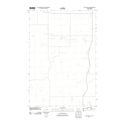
2011 Map of Cannon Ball SW
USGS Topo · Published 2011About this map
Beaver Holes Creek winds through this expanse of the Cannonball District in Sioux County, where the prairie landscape is defined by a sparse network of section-line roads and seasonal watercourses. The drainage patterns of the Missouri River plateau are clearly visible, with Fool Bear Creek and Battle Creek cutting through the terrain. This 2011 record of the landscape reveals a largely undeveloped rural region, where infrastructure is limited to primary corridors like 14th Ave SW and 75th St. Local historians can observe the unchanged natural topography and the orientation of modern county roads that follow the historic land survey grid, marking the quiet character of south-central North Dakota just north of the South Dakota border.
Find a feature on this map
7 named features on this map. Tap any name to fly to it.
Don’t see what you’re looking for? This feature index may not catch every label — zoom into the map to look around manually.
Map Details
Editions of this 2011 Cannon Ball SW Map
This is the sole edition of this map. No revisions or reprints were ever made.
Other maps of this area

1954 · Bismarck
USGS Topo · 1:250,000

1958 · Bismarck
USGS Topo · 1:250,000

1968 · Cannon Ball
USGS Topo · 1:24,000

1968 · Cannon Ball SE
USGS Topo · 1:24,000

1968 · Fort Yates NW
USGS Topo · 1:24,000

1968 · Cannon Ball NW
USGS Topo · 1:24,000

1968 · Fort Yates NE
USGS Topo · 1:24,000

1968 · Cannon Ball SW
USGS Topo · 1:24,000

1971 · Barren Butte
USGS Topo · 1:24,000

1971 · Half Timber Butte
USGS Topo · 1:24,000