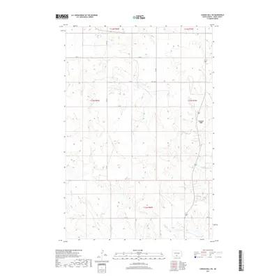
2017 Map of Cannon Ball SW
USGS Topo · Published 2017About this map
Cannon Ball anchors the eastern edge of this landscape, situated near the winding drainage of Beaver Holes Cr. This 2017 topographic record of Sioux County shows a rural expanse defined by its seasonal waterways and a sparse grid of section-line roads like S Big Lake Rd and 73rd St. The drainage patterns are clearly delineated, with Battle Cr and Bong Cr cutting through the western and southern reaches of the quadrangle. For researchers tracking the modern footprint of the Standing Rock Reservation area, the map provides precise locations for local roads and named topographical features, including Fool Bear Cr in the southeast. The land remains largely open, marked by the traditional township and range divisions of the Public Land Survey System that have shaped North Dakota's geography for over a century.
Find a feature on this map
17 named features on this map. Tap any name to fly to it.
Don’t see what you’re looking for? This feature index may not catch every label — zoom into the map to look around manually.
Map Details
Editions of this 2017 Cannon Ball SW Map
This is the sole edition of this map. No revisions or reprints were ever made.
Other maps of this area

1954 · Bismarck
USGS Topo · 1:250,000

1958 · Bismarck
USGS Topo · 1:250,000

1968 · Cannon Ball
USGS Topo · 1:24,000

1968 · Cannon Ball SE
USGS Topo · 1:24,000

1968 · Fort Yates NW
USGS Topo · 1:24,000

1968 · Cannon Ball NW
USGS Topo · 1:24,000

1968 · Fort Yates NE
USGS Topo · 1:24,000

1968 · Cannon Ball SW
USGS Topo · 1:24,000

1971 · Barren Butte
USGS Topo · 1:24,000

1971 · Half Timber Butte
USGS Topo · 1:24,000