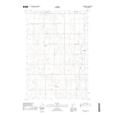
2020 Map of Cannon Ball SW
USGS Topo · Published 2020About this map
Cannon Ball anchors the eastern edge of this landscape in the Standing Rock Reservation, where the terrain is defined by a network of seasonal drainages cutting through the prairie. The hydrology of the region is traced by the winding paths of Beaver Holes Cr, Fool Bear Cr, and Battle Cr, which reveal the natural erosion patterns of the Missouri River plateau. The road system follows a strict township and range grid, with rural routes such as S Big Lake Rd, 80th St, and 14th Ave providing access to the isolated homesteads and grazing lands. This 2020 survey illustrates how modern infrastructure remains tethered to the section lines established over a century ago, maintaining a sparsely populated character where geography is primarily dictated by the flow of water toward the larger river basins to the east.
Find a feature on this map
17 named features on this map. Tap any name to fly to it.
Don’t see what you’re looking for? This feature index may not catch every label — zoom into the map to look around manually.
Map Details
Editions of this 2020 Cannon Ball SW Map
This is the sole edition of this map. No revisions or reprints were ever made.
Other maps of this area

1954 · Bismarck
USGS Topo · 1:250,000

1958 · Bismarck
USGS Topo · 1:250,000

1968 · Cannon Ball
USGS Topo · 1:24,000

1968 · Cannon Ball SE
USGS Topo · 1:24,000

1968 · Fort Yates NW
USGS Topo · 1:24,000

1968 · Cannon Ball NW
USGS Topo · 1:24,000

1968 · Fort Yates NE
USGS Topo · 1:24,000

1968 · Cannon Ball SW
USGS Topo · 1:24,000

1971 · Barren Butte
USGS Topo · 1:24,000

1971 · Half Timber Butte
USGS Topo · 1:24,000