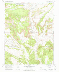
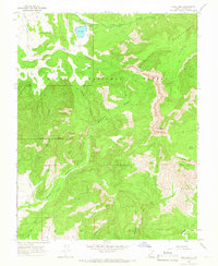
1966 Map of Cannonville
USGS Topo · Published 1979About this map
Tropic and Cannonville anchor a network of small high-desert settlements where the Tropic Valley meets the winding Paria River. In the mid-1960s, the landscape was defined by the intersection of irrigation, early tourism, and high-plateau geography, with Bryce Canyon National Park touching the northwestern corner of the quadrangle. The map reveals the functional infrastructure of these rural communities, from the Bryce Valley Sch and local Cem sites to a Water Tank and Siphon that hint at the water management required in this arid terrain.
Find a feature on this map
41 named features on this map. Tap any name to fly to it.
Don’t see what you’re looking for? This feature index may not catch every label — zoom into the map to look around manually.
Map Details
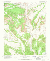
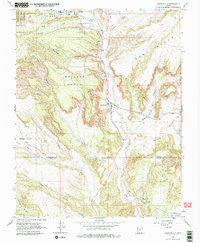
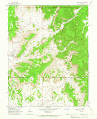
Editions of this 1966 Cannonville Map
3 editions found
Other maps of this area

1886 · Kanab
USGS Topo · 1:250,000

1886 · Escalante
USGS Topo · 1:250,000

1953 · Cedar City
USGS Topo · 1:250,000

1956 · Escalante
USGS Topo · 1:250,000

1958 · Cedar City
USGS Topo · 1:250,000

1960 · Escalante
USGS Topo · 1:250,000

1962 · Cedar City
USGS Topo · 1:250,000
1964 · Henrieville
USGS Topo · 1:24,000
1964 · Pine Lake
USGS Topo · 1:24,000
1964 · Slickrock Bench
USGS Topo · 1:24,000