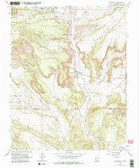
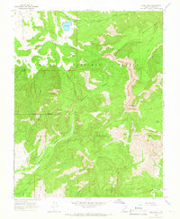
1966 Map of Cannonville
USGS Topo · Published 1979About this map
Tropic and Cannonville serve as the primary hubs in this mid-1960s survey of southern Utah, where the Paria River carves through a landscape of high benches and deep hollows. The settlement at Georgetown appears further south along the river valley, while the presence of the Bryce Valley Sch and local Cem markers indicate the established community life of the era. The terrain transitions from the eastern edge of Bryce Canyon National Park into extensive upland features like Bulldog Bench and Coal Bench. Resource extraction is evidenced by a Mine and Gravel Pit, while water management is highlighted by a Siphon and Water Tank near the northern settlements. This period shows a mix of traditional ranching geography and modern infrastructure, including a Jeep Trail winding through Jim Hollow and Sheep Creek.
Find a feature on this map
35 named features on this map. Tap any name to fly to it.
Don’t see what you’re looking for? This feature index may not catch every label — zoom into the map to look around manually.
Map Details
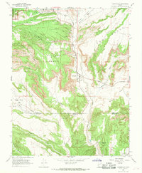
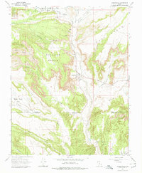
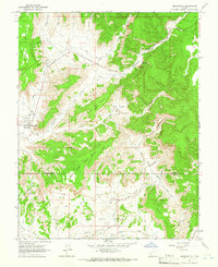
Editions of this 1966 Cannonville Map
3 editions found
Other maps of this area

1886 · Kanab
USGS Topo · 1:250,000

1886 · Escalante
USGS Topo · 1:250,000

1953 · Cedar City
USGS Topo · 1:250,000

1956 · Escalante
USGS Topo · 1:250,000

1958 · Cedar City
USGS Topo · 1:250,000

1960 · Escalante
USGS Topo · 1:250,000

1962 · Cedar City
USGS Topo · 1:250,000
1964 · Henrieville
USGS Topo · 1:24,000
1964 · Pine Lake
USGS Topo · 1:24,000
1964 · Slickrock Bench
USGS Topo · 1:24,000