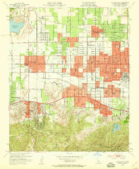
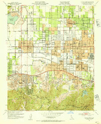
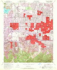
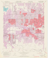
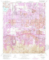
1952 Map of Canoga Park
USGS Topo · Published 1959About this map
The San Fernando Valley is shown here in a transformative mid-century state, where post-war suburban development meets the agricultural and equestrian roots of Los Angeles. Neighborhoods like Northridge, Winnetka, and Reseda are structured by a rigid grid of boulevards, yet large swaths of land remain dedicated to specialized institutions such as the C W Pierce School of Agr and the Ridgewood Military Academy. Along the southern boundary, the Santa Monica Mountains rise sharply, hosting the winding Mulholland Drive and lookouts like San Vicente Mtn. The map reveals the critical water infrastructure of the era, from the Chatsworth Reservoir in the northwest to the Encino Reservoir and the Sepulveda Flood Control Basin in the east. This period captures a landscape where the Southern Pacific rail line still services agricultural stops like Tarzana Siding even as the region transitions toward a residential hub.
Find a feature on this map
93 named features on this map. Tap any name to fly to it.
Don’t see what you’re looking for? This feature index may not catch every label — zoom into the map to look around manually.
Map Details
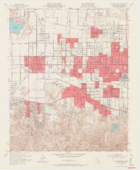
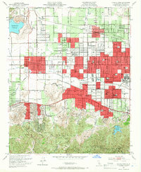
Editions of this 1952 Canoga Park Map
7 editions found
Other maps of this area

1894 · Los Angeles
USGS Topo · 1:62,500

1896 · Santa Monica
USGS Topo · 1:62,500

1898 · Santa Monica
USGS Topo · 1:62,500

1900 · Los Angeles
USGS Topo · 1:62,500

1900 · Fernando
USGS Topo · 1:62,500

1901 · Southern California Sheet No. 1
USGS Topo · 1:250,000

1902 · Santa Monica
USGS Topo · 1:62,500

1903 · Calabasas
USGS Topo · 1:62,500

1903 · Camulos
USGS Topo · 1:125,000

1903 · Santa Susana
USGS Topo · 1:62,500