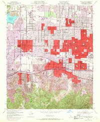
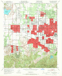
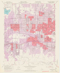
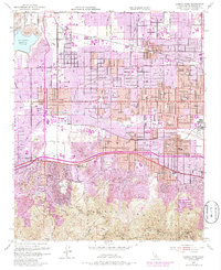
1952 Map of Canoga Park
USGS Topo · Published 1968About this map
The San Fernando Valley undergoes a visible transformation on this map, showing the post-war suburbanization of City Of Los Angeles. Residential subdivisions, shown in red and purple update tints, sweep across former citrus and field crops between Canoga Park, Reseda, and Northridge. Amidst this growth, the Southern Pacific railroad maintains its presence with industrial infrastructure like Tarzana Siding, while the Los Angeles River cuts through the emerging street grid.
Find a feature on this map
76 named features on this map. Tap any name to fly to it.
Don’t see what you’re looking for? This feature index may not catch every label — zoom into the map to look around manually.
Map Details
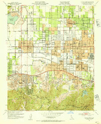
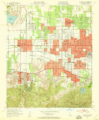
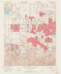
Editions of this 1952 Canoga Park Map
7 editions found
Other maps of this area

1894 · Los Angeles
USGS Topo · 1:62,500

1896 · Santa Monica
USGS Topo · 1:62,500

1898 · Santa Monica
USGS Topo · 1:62,500

1900 · Los Angeles
USGS Topo · 1:62,500

1900 · Fernando
USGS Topo · 1:62,500

1901 · Southern California Sheet No. 1
USGS Topo · 1:250,000

1902 · Santa Monica
USGS Topo · 1:62,500

1903 · Calabasas
USGS Topo · 1:62,500

1903 · Camulos
USGS Topo · 1:125,000

1903 · Santa Susana
USGS Topo · 1:62,500