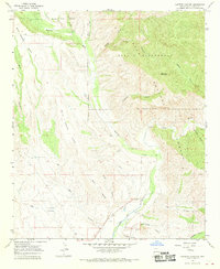
1965 Map of Canteen Canyon
USGS Topo · Published 1970About this map
Mogollon Creek cuts through the high desert terrain of the Gila National Forest in this mid-1960s survey, where the rugged topography transitions into the protected Gila Wilderness. The landscape is defined by massive formations like Wild Horse Mesa and Mud Spring Mesa, with the southern reaches following the life-giving corridor of the Gila River. Water management is central to the area's development, evidenced by the Fort West Ditch, an Aqueduct, and numerous strategically placed infrastructure points such as Shelley Well and various water tanks.
Find a feature on this map
37 named features on this map. Tap any name to fly to it.
Don’t see what you’re looking for? This feature index may not catch every label — zoom into the map to look around manually.
Map Details
Editions of this 1965 Canteen Canyon Map
2 editions found
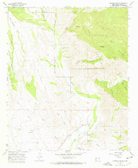
Other maps of this area

1909 · Silver City
USGS Topo · 1:125,000

1910 · Mogollon
USGS Topo · 1:125,000

1911 · Alum Mountain
USGS Topo · 1:125,000

1912 · Mogollon
USGS Topo · 1:125,000

1913 · Alum Mountain
USGS Topo · 1:125,000

1950 · Dorsey Ranch
USGS Topo · 1:24,000

1951 · Dorsey Ranch
USGS Topo · 1:24,000

1954 · Silver City
USGS Topo · 1:250,000

1954 · Clifton
USGS Topo · 1:250,000

1957 · Clifton
USGS Topo · 1:250,000