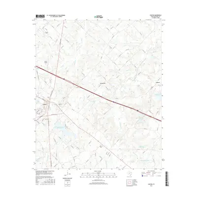
2016 Map of Canton
USGS Topo · Published 2016About this map
Canton serves as the focal point of this East Texas survey, revealing a landscape defined by its crossroads and the many small watercourses that feed the Grand Saline Cr and Mill Cr. The town's grid is detailed near City Lake, while local roads like N Trade Days Blvd and First Monday Ln point to the area's well-known regional commerce traditions. Beyond the municipal limits, the map documents small rural clusters such as Red Hill, Wentworth, and Oakland, each often centered around community landmarks like Oakland Cem or Morris Chapel Cem. The terrain is punctuated by numerous managed water bodies, including the Soil Conservation Service Site Number 1 Reservoir and several named lakes such as Club Twenty Lake and Kellum Number 1 Lake. Aviation infrastructure is represented by the Canton-Hackney Airport and Thompson Field in the northwest, showing the integration of modern transit into the traditional agricultural landscape of Van Zandt County.
Find a feature on this map
119 named features on this map. Tap any name to fly to it.
Don’t see what you’re looking for? This feature index may not catch every label — zoom into the map to look around manually.
Map Details
Editions of this 2016 Canton Map
This is the sole edition of this map. No revisions or reprints were ever made.
Other maps of this area

1948 · Brownsboro
USGS Topo · 1:62,500

1948 · Martins Mill
USGS Topo · 1:62,500

1949 · Martins Mill
USGS Topo · 1:62,500

1949 · Brownsboro
USGS Topo · 1:62,500

1956 · Tyler
USGS Topo · 1:250,000

1959 · Grand Saline
USGS Topo · 1:24,000

1959 · Van
USGS Topo · 1:24,000

1959 · Grand Saline
USGS Topo · 1:62,500

1962 · Myrtle Springs
USGS Topo · 1:24,000
1962 · Canton
USGS Topo · 1:24,000