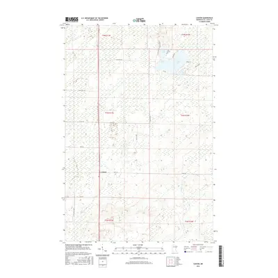
2016 Map of Canyon
USGS Topo · Published 2016About this map
Canyon serves as the primary settlement hub for this portion of Saint Louis County, situated along a north-south transportation corridor that anchors the local landscape. The surrounding area is defined by a dense network of wetlands and small water bodies characteristic of northern Minnesota, including Leora Lake, Winkle Lake, and Moose Lake. These features, along with smaller tributaries like Hellwig Cr and Chicken Cr, suggest a terrain shaped by post-glacial drainage patterns. Local road networks, such as Co Hwy 133 and Harris Rd, connect scattered rural residences and forestry tracts, providing a clear view of the modern land-use patterns in this region. The map also delineates several township boundaries, including t53n r17w and t54n r16w, which trace the historical Public Land Survey System grid that organized the settlement of the Iron Range hinterlands.
Find a feature on this map
30 named features on this map. Tap any name to fly to it.
Don’t see what you’re looking for? This feature index may not catch every label — zoom into the map to look around manually.
Map Details
Editions of this 2016 Canyon Map
This is the sole edition of this map. No revisions or reprints were ever made.
Other maps of this area

1953 · Twig
USGS Topo · 1:24,000

1953 · Canyon
USGS Topo · 1:24,000

1953 · Shaw
USGS Topo · 1:24,000

1953 · Payne
USGS Topo · 1:24,000

1953 · Alborn
USGS Topo · 1:24,000

1953 · Independence
USGS Topo · 1:24,000

1953 · Duluth
USGS Topo · 1:250,000

1954 · Hibbing
USGS Topo · 1:250,000

1956 · Cotton
USGS Topo · 1:24,000

1956 · Whiteface
USGS Topo · 1:24,000