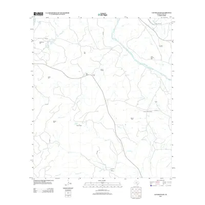
2012 Map of Cap Mountain
USGS Topo · Published 2012About this map
The Llano River cuts through this Llano County landscape, where the topography is defined by high points like Cap Mtn, Dancer Peak, and Moore Peak. This 2012 survey illustrates the network of rural routes, including the historic Old Kingsland-Llano Rd, that connect local ranches and family landmarks. Genealogists will find significant value in the distribution of several rural burial grounds, such as Cap Mtn Cem and Pennington Creek Cem, which are tucked away near watercourses like Pennington Cr. The map also captures the Flying H Ranch Airport and large ranching tracts like Granite Hills Ranch, reflecting the modern rural land use in this part of Texas. Creeks and hollows, such as Devils Hollow and Molasses Cr, further detail the drainage patterns of the region.
Find a feature on this map
32 named features on this map. Tap any name to fly to it.
Don’t see what you’re looking for? This feature index may not catch every label — zoom into the map to look around manually.
Map Details
Editions of this 2012 Cap Mountain Map
This is the sole edition of this map. No revisions or reprints were ever made.
Other maps of this area

1887 · Llano
USGS Topo · 1:125,000

1887 · Burnet
USGS Topo · 1:125,000

1893 · Burnet
USGS Topo · 1:125,000

1894 · Llano
USGS Topo · 1:125,000

1903 · Burnet
USGS Topo · 1:125,000

1904 · Llano
USGS Topo · 1:125,000

1909 · Llano
USGS Topo · 1:125,000

1909 · Burnet
USGS Topo · 1:125,000

1918 · Llano
USGS Topo · 1:125,000

1925 · Burnet 3-b
USGS Topo · 1:48,000