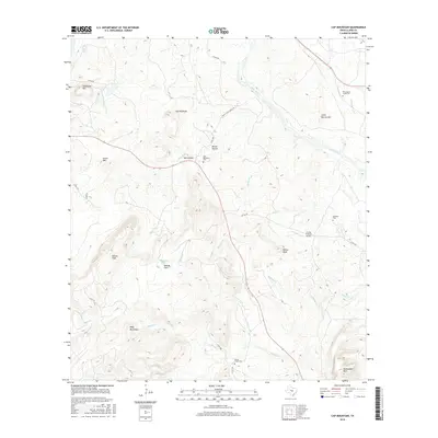
2016 Map of Cap Mountain
USGS Topo · Published 2016About this map
Cap Mountain stands as a prominent central landmark in this portion of Llano County, where the topography transition from the high Riley Mountains toward the Llano River valley. The settlement at Salt Hollow and the scattered rural landmarks reveal a landscape defined by ranching and local history, anchored by several family and community burial grounds including Cap Mountain Cem and Honey Creek Cem. The drainage patterns are intricate, with seasonal and permanent watercourses such as Honey Cr, Molasses Cr, and Bedford Cr cutting through the terrain. Evidence of modern land use is visible at the Flying H Ranch Airport, while older mountain names like Packsaddle Mtn and Dancer Peak evoke the area’s longstanding geographic identity. The map provides a clear record of the rural road network, from Chanas Ranch Back Rd to the various county routes that connect these high-country ranches.
Find a feature on this map
34 named features on this map. Tap any name to fly to it.
Don’t see what you’re looking for? This feature index may not catch every label — zoom into the map to look around manually.
Map Details
Editions of this 2016 Cap Mountain Map
This is the sole edition of this map. No revisions or reprints were ever made.
Other maps of this area

1887 · Llano
USGS Topo · 1:125,000

1887 · Burnet
USGS Topo · 1:125,000

1893 · Burnet
USGS Topo · 1:125,000

1894 · Llano
USGS Topo · 1:125,000

1903 · Burnet
USGS Topo · 1:125,000

1904 · Llano
USGS Topo · 1:125,000

1909 · Llano
USGS Topo · 1:125,000

1909 · Burnet
USGS Topo · 1:125,000

1918 · Llano
USGS Topo · 1:125,000

1925 · Burnet 3-b
USGS Topo · 1:48,000