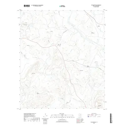
2019 Map of Cap Mountain
USGS Topo · Published 2019About this map
Cap Mountain and the Riley Mountains dominate this 2019 survey of the Texas Hill Country, where deep drainages like Devils Hollow and Salt Hollow carve into the limestone plateau. The topography is defined by prominent peaks including Dancer Peak and Packsaddle Mtn, with the Llano River sweeping across the northeastern corner. This modern survey reflects a landscape of sprawling ranch lands and private airfields, notably the Flying H Ranch Airport.
Find a feature on this map
34 named features on this map. Tap any name to fly to it.
Don’t see what you’re looking for? This feature index may not catch every label — zoom into the map to look around manually.
Map Details
Editions of this 2019 Cap Mountain Map
This is the sole edition of this map. No revisions or reprints were ever made.
Other maps of this area

1887 · Llano
USGS Topo · 1:125,000

1887 · Burnet
USGS Topo · 1:125,000

1893 · Burnet
USGS Topo · 1:125,000

1894 · Llano
USGS Topo · 1:125,000

1903 · Burnet
USGS Topo · 1:125,000

1904 · Llano
USGS Topo · 1:125,000

1909 · Llano
USGS Topo · 1:125,000

1909 · Burnet
USGS Topo · 1:125,000

1918 · Llano
USGS Topo · 1:125,000

1925 · Burnet 3-b
USGS Topo · 1:48,000