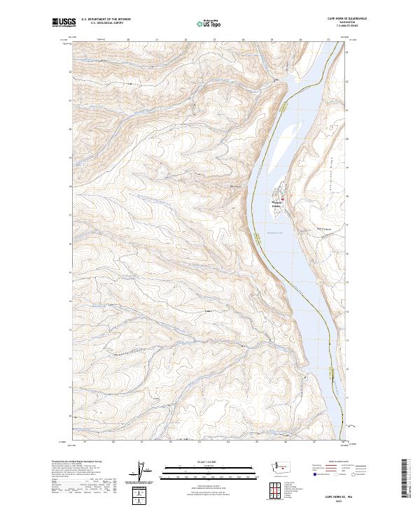
2023 Map of Cape Horn SE
USGS Topo · Published 2023About this map
Sunland Estates occupies a unique riverside position on the eastern bank of the Columbia River, marking a pocket of development against the expansive conservation lands of the Colockum Game Range. The landscape is defined by dramatic elevation changes where the river has carved deep through the basalt, most notably at Box Canyon and the wide plateau of Babcock Bench. This stretch of the river, known here as Wanapum Lake, is fed by an intricate network of drainage systems including Quilomene Creek and the North Fork Skookumchuck Creek. This 2023 survey illustrates the contrast between the established residential street grid of Sunland Estates and the wilder, stream-cut canyons to the west. Further inland, Evergreen Ridge rises above the river valley, while scattered water sources like Blankenship Spring and Kohler Spring dot the dry upland terrain.
Find a feature on this map
33 named features on this map. Tap any name to fly to it.
Don’t see what you’re looking for? This feature index may not catch every label — zoom into the map to look around manually.
Map Details
Editions of this 2023 Cape Horn SE Map
This is the sole edition of this map. No revisions or reprints were ever made.
Other maps of this area

1909 · Quincy
USGS Topo · 1:62,500

1910 · Quincy
USGS Topo · 1:62,500

1912 · Beverly
USGS Topo · 1:62,500

1920 · Colockum Pass
USGS Topo · 1:125,000

1922 · Colockum Pass
USGS Topo · 1:125,000

1939 · Boylston
USGS Topo · 1:48,000

1943 · Boylston
USGS Topo · 1:62,500

1950 · Yakima
USGS Topo · 1:250,000

1953 · Ginkgo
USGS Topo · 1:24,000
1953 · Boylston
USGS Topo · 1:24,000