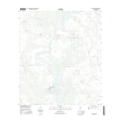
2016 Map of Capers Ridge
USGS Topo · Published 2016About this map
The Trinity River dominates this portion of Liberty County, winding through a complex system of oxbow lakes, bayous, and wetlands that define the local geography. The settlement of Dayton Lakes sits along the river's eastern bank, surrounded by a dense network of water bodies such as Pecan Lake, New Old River Lake, and Rosewood Lake. These features reflect the dynamic hydrology of the river basin, where old channels have separated from the main flow to create a unique riparian environment.
Find a feature on this map
78 named features on this map. Tap any name to fly to it.
Don’t see what you’re looking for? This feature index may not catch every label — zoom into the map to look around manually.
Map Details
Editions of this 2016 Capers Ridge Map
This is the sole edition of this map. No revisions or reprints were ever made.
Other maps of this area

1943 · Liberty
USGS Topo · 1:125,000

1954 · Beaumont
USGS Topo · 1:250,000

1955 · Daisetta
USGS Topo · 1:62,500

1955 · Saratoga
USGS Topo · 1:62,500

1955 · Rayburn
USGS Topo · 1:62,500

1955 · Liberty
USGS Topo · 1:62,500

1957 · Beaumont
USGS Topo · 1:250,000

1984 · Beaumont
USGS Topo · 1:250,000
1984 · Arizona Creek
USGS Topo · 1:24,000
1984 · Dayton
USGS Topo · 1:24,000