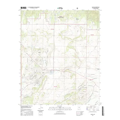
2017 Map of Capitan
USGS Topo · Published 2017About this map
Capitan sits at the base of the Capitan Mountains on this 2017 survey of Lincoln County, New Mexico. The landscape is defined by the transitions between the village and the protected reaches of the Lincoln National Forest, where a network of water management features like Hondo Tank and Southwest Tank support the arid high-desert environment. To the north, the settlement of Coalora lies near the N Fork Salado Cr, reflecting the region’s development patterns as infrastructure follows the natural drainage basins. Significant local topography, including Gyp Spring Canyon and the headwaters of Rio Bonito, shapes the road and trail systems. The map also traces historical travel routes like the Tucson Trail, which cuts across the northwestern corner of the quadrangle.
Find a feature on this map
82 named features on this map. Tap any name to fly to it.
Don’t see what you’re looking for? This feature index may not catch every label — zoom into the map to look around manually.
Map Details
Editions of this 2017 Capitan Map
This is the sole edition of this map. No revisions or reprints were ever made.
Other maps of this area

1934 · Capitan
USGS Topo · 1:48,000

1935 · Capitan Mountains
USGS Topo · 1:48,000

1937 · Capitan
USGS Topo · 1:62,500

1940 · Capitan Mountains
USGS Topo · 1:62,500

1955 · Roswell
USGS Topo · 1:250,000

1958 · Roswell
USGS Topo · 1:250,000

1961 · Lincoln
USGS Topo · 1:62,500

1962 · Roswell
USGS Topo · 1:250,000

1963 · Fort Stanton
USGS Topo · 1:24,000

1963 · Angus
USGS Topo · 1:24,000