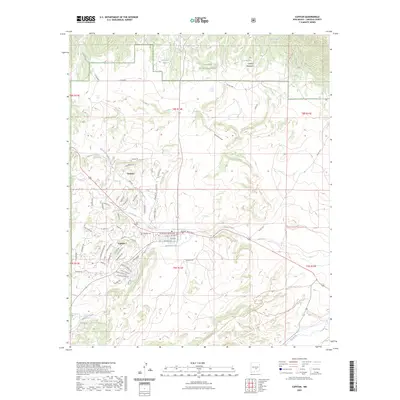
2023 Map of Capitan
USGS Topo · Published 2023About this map
Capitan sits at the heart of this landscape, where the high desert meets the northern edges of the Lincoln Mountains and the Lincoln National Forest. The map documents the residential and street-level expansion of this mountain community, including landmarks like the Capitan Cem and several seasonal watercourses such as Oso Creek and Salado Creek. To the north, the settlement of Coalora remains a distinct point of interest, established near the mouth of the North Fork Salado Creek. This area is defined by its drainage systems, with Magado Creek cutting through the southern portion of the village before the terrain rises toward the West Mesa Trl. The inclusion of the historic Tucson Trail and several cattle tanks, like Hondo Tank, reflects the long-standing ranching and transit history of this Lincoln County region.
Find a feature on this map
78 named features on this map. Tap any name to fly to it.
Don’t see what you’re looking for? This feature index may not catch every label — zoom into the map to look around manually.
Map Details
Editions of this 2023 Capitan Map
This is the sole edition of this map. No revisions or reprints were ever made.
Other maps of this area

1934 · Capitan
USGS Topo · 1:48,000

1935 · Capitan Mountains
USGS Topo · 1:48,000

1937 · Capitan
USGS Topo · 1:62,500

1940 · Capitan Mountains
USGS Topo · 1:62,500

1955 · Roswell
USGS Topo · 1:250,000

1958 · Roswell
USGS Topo · 1:250,000

1961 · Lincoln
USGS Topo · 1:62,500

1962 · Roswell
USGS Topo · 1:250,000

1963 · Fort Stanton
USGS Topo · 1:24,000

1963 · Angus
USGS Topo · 1:24,000