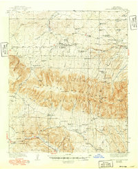
1940 Map of Capitan Mountains
USGS Topo · Published 1949About this map
The Lincoln National Forest dominates this landscape, defined by the towering Capitan Mountains and the prominent Capitan Peak. This mid-century survey reveals a rural economy centered on cattle ranching and government land management, with numerous family ranch holdings such as Merchant Ranch, Padilla Ranch, and Shoemaker Ranch spread across the canyon-cut terrain. To the south, the presence of the U S Marine Hospital Reservation near the Rio Bonito marks a significant institutional footprint in the high desert of Lincoln County.
Find a feature on this map
65 named features on this map. Tap any name to fly to it.
Don’t see what you’re looking for? This feature index may not catch every label — zoom into the map to look around manually.
Map Details
Editions of this 1940 Capitan Mountains Map
2 editions found
Other maps of this area

1934 · Capitan
USGS Topo · 1:48,000

1935 · Capitan Mountains
USGS Topo · 1:48,000

1936 · Arabela
USGS Topo · 1:48,000

1937 · Capitan
USGS Topo · 1:62,500

1940 · Capitan Mountains
USGS Topo · 1:62,500

1942 · Arabela
USGS Topo · 1:62,500

1955 · Roswell
USGS Topo · 1:250,000

1958 · Roswell
USGS Topo · 1:250,000

1961 · Lincoln
USGS Topo · 1:62,500

1961 · Tinnie
USGS Topo · 1:62,500