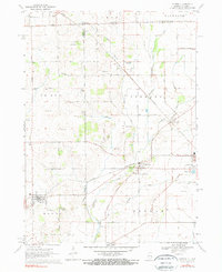
1970 Map of Capron
USGS Topo · Published 1972About this map
Capron and Chemung serve as the primary hubs in this agricultural region along the border of Illinois and Wisconsin. The landscape is defined by the Chicago and North Western railroad, which bisects the territory, connecting these small settlements to the broader regional economy. Numerous small cemeteries, such as Burr Oak Cem and Chemung-Dunham Cem, are scattered across the rural townships of LeRoy and Dunham, providing vital geographic anchors for genealogical research.
Find a feature on this map
41 named features on this map. Tap any name to fly to it.
Don’t see what you’re looking for? This feature index may not catch every label — zoom into the map to look around manually.
Map Details
Editions of this 1970 Capron Map
Other maps of this area

1893 · Delavan
USGS Topo · 1:62,500

1893 · Shopiere
USGS Topo · 1:62,500

1918 · Belvidere
USGS Topo · 1:62,500

1932 · Harvard
USGS Topo · 1:48,000

1937 · Harvard
USGS Topo · 1:62,500

1944 · Belvidere
USGS Topo · 1:62,500

1954 · Rockford
USGS Topo · 1:250,000

1955 · Rockford
USGS Topo · 1:250,000

1958 · Rockford
USGS Topo · 1:250,000
1960 · Delavan
USGS Topo · 1:62,500