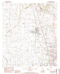
1983 Map of Carencro
USGS Topo · Published 1983About this map
Carencro and its surrounding prairie landscape are defined by the convergence of agricultural traditions and the expanding energy industry of the early 1980s. The map illustrates a region where local watercourses like Bayou Carencro and Coulee Mine intersect with significant industrial development, most notably the North Cankton Oil and Gas Field and Vatican Oil and Gas Field. These fields indicate the subsurface wealth that shaped the local economy alongside traditional farming.
Find a feature on this map
23 named features on this map. Tap any name to fly to it.
Don’t see what you’re looking for? This feature index may not catch every label — zoom into the map to look around manually.
Map Details
Editions of this 1983 Carencro Map
2 editions found
Other maps of this area

1934 · Duson
USGS Topo · 1:31,680

1939 · St. Martinsville
USGS Topo · 1:62,500

1940 · Arnaudville
USGS Topo · 1:62,500

1946 · Lafayette
USGS Topo · 1:31,680

1952 · Lake Charles
USGS Topo · 1:250,000

1954 · Lafayette
USGS Topo · 1:31,680

1954 · Duson
USGS Topo · 1:31,680

1954 · Lake Charles
USGS Topo · 1:250,000

1954 · Baton Rouge
USGS Topo · 1:250,000

1955 · Lafayette
USGS Topo · 1:24,000