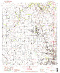
1983 Map of Carencro
USGS Topo · Published 1983About this map
Carencro serves as the central hub of this South Louisiana landscape, where the agricultural traditions of Lafayette Parish meet the emerging industrial energy of the early 1980s. The terrain is defined by a complex drainage network, including Bayou Carencro and Coulee des Cannes, which historically dictated the placement of small prairie settlements. This era shows a significant intersection of transport and extraction, with the Southern Pacific railroad cutting north-south through the parish line near several expansive energy deposits like the Shuteston Oil and Gas Field and the Vatican Oil and Gas Field.
Find a feature on this map
23 named features on this map. Tap any name to fly to it.
Don’t see what you’re looking for? This feature index may not catch every label — zoom into the map to look around manually.
Map Details
Editions of this 1983 Carencro Map
2 editions found
Other maps of this area

1934 · Duson
USGS Topo · 1:31,680

1939 · St. Martinsville
USGS Topo · 1:62,500

1940 · Arnaudville
USGS Topo · 1:62,500

1946 · Lafayette
USGS Topo · 1:31,680

1952 · Lake Charles
USGS Topo · 1:250,000

1954 · Lafayette
USGS Topo · 1:31,680

1954 · Duson
USGS Topo · 1:31,680

1954 · Lake Charles
USGS Topo · 1:250,000

1954 · Baton Rouge
USGS Topo · 1:250,000

1955 · Lafayette
USGS Topo · 1:24,000