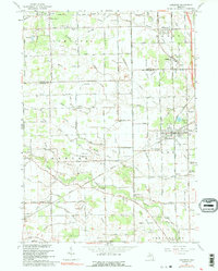
1967 Map of Carleton
USGS Topo · Published 1991About this map
Carleton serves as a central junction where the Detroit Toledo and Ironton and Chesapeake and Ohio railroads intersect, shaping the rural landscape of Monroe and Wayne Counties. The terrain is defined by an extensive network of managed drainage, including Carroll Drain and Disbrow Drain, which support the agricultural tracts between established communities like Waltz and Grafton. This 1967 revision highlights a transition from traditional one-room schoolhouses to modern facilities, as older sites like Red Sch and McGowan Sch sit in contrast to the larger Airport High Sch. Small religious and social centers, such as Sumpter Community Ch and Bethlehem Temple Ch, remain scattered across the townships of Sumpter and Huron, marking the local heritage of these farming communities before further suburban expansion reached the area.
Find a feature on this map
107 named features on this map. Tap any name to fly to it.
Don’t see what you’re looking for? This feature index may not catch every label — zoom into the map to look around manually.
Map Details
Editions of this 1967 Carleton Map
3 editions found
Other maps of this area

1902 · Ypsilanti
USGS Topo · 1:62,500

1904 · Ann Arbor
USGS Topo · 1:125,000

1906 · Ypsilanti
USGS Topo · 1:62,500

1906 · Romulus
USGS Topo · 1:62,500

1908 · Ann Arbor
USGS Topo · 1:125,000

1912 · Monroe
USGS Topo · 1:62,500

1912 · Dundee
USGS Topo · 1:62,500

1914 · Monroe
USGS Topo · 1:62,500

1926 · Dundee
USGS Topo · 1:62,500

1927 · Monroe
USGS Topo · 1:31,680
Featured Places
- Frenchtown Charter Township, MI
- Huron Charter Township, MI
- Sumpter Township, MI
- Ash Township, MI
- Raisinville Township, MI