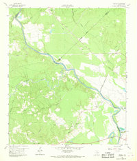
1960 Map of Carlisle
USGS Topo · Published 1968About this map
The Trinity River winds through this 1960 landscape, serving as a natural boundary for San Jacinto, Trinity, and Polk counties. The map captures a rural Texas interior defined by small family and community centers, including Carlisle and Mc Duffie. Notable for local historians is the recorded Patricks Ferry (Site) and the nearby Patricks Cem, indicating the historic importance of river crossings before modern infrastructure dominated the region.
Find a feature on this map
31 named features on this map. Tap any name to fly to it.
Don’t see what you’re looking for? This feature index may not catch every label — zoom into the map to look around manually.
Map Details
Editions of this 1960 Carlisle Map
3 editions found
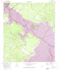
Other maps of this area

1954 · Beaumont
USGS Topo · 1:250,000

1957 · Beaumont
USGS Topo · 1:250,000

1960 · Blanchard
USGS Topo · 1:24,000

1960 · Colita
USGS Topo · 1:24,000

1960 · Trinity East
USGS Topo · 1:24,000

1960 · Carlisle
USGS Topo · 1:24,000

1960 · Stephen Creek
USGS Topo · 1:24,000

1961 · Staley
USGS Topo · 1:24,000

1961 · Onalaska
USGS Topo · 1:24,000

1961 · Oakhurst
USGS Topo · 1:24,000