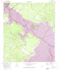
1960 Map of Carlisle
USGS Topo · Published 1974About this map
Trinity River waters dominate this 1960s landscape, which was caught in a moment of significant geographic change. The creation of Lake Livingston is documented here through purple revisions, indicating controlled inundation zones that would soon submerge the historic floodplain. This transformation affected the river's path across the San Jacinto Co, Trinity Co, and Polk Co boundaries. On the high ground west of the rising waters, the settlement of Pointblank remains anchored by the Pointblank School and Liberty Hill Cem. To the north, the small community of Carlisle sits near the headwaters of Harts Creek. The map also preserves the locations of local landmarks such as Darby Hill and the Pine Valley Ch, providing a detailed look at the rural social fabric before the reservoir fully reshaped the region's topography.
Find a feature on this map
25 named features on this map. Tap any name to fly to it.
Don’t see what you’re looking for? This feature index may not catch every label — zoom into the map to look around manually.
Map Details
Editions of this 1960 Carlisle Map
3 editions found
Other maps of this area

1954 · Beaumont
USGS Topo · 1:250,000

1957 · Beaumont
USGS Topo · 1:250,000

1960 · Blanchard
USGS Topo · 1:24,000

1960 · Colita
USGS Topo · 1:24,000

1960 · Trinity East
USGS Topo · 1:24,000

1960 · Carlisle
USGS Topo · 1:24,000

1960 · Stephen Creek
USGS Topo · 1:24,000

1961 · Staley
USGS Topo · 1:24,000

1961 · Onalaska
USGS Topo · 1:24,000

1961 · Oakhurst
USGS Topo · 1:24,000