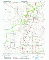
1974 Map of Carlisle
USGS Topo · Published 1991About this map
Carlisle and Oaktown serve as the primary hubs in this agricultural pocket of Indiana, situated along the Louisville and Nashville railroad. The landscape is defined by the winding course of Busseron Creek and its tributaries, including Tanyard Branch and Marsh Creek. An Indian Treaty Boundary cuts diagonally across the northern townships, a significant historical line that influenced land surveying and settlement patterns in Haddon and Gill.
Find a feature on this map
41 named features on this map. Tap any name to fly to it.
Don’t see what you’re looking for? This feature index may not catch every label — zoom into the map to look around manually.
Map Details
Editions of this 1974 Carlisle Map
2 editions found
Other maps of this area

1917 · Birds
USGS Topo · 1:62,500

1942 · Birds
USGS Topo · 1:62,500

1943 · Merom
USGS Topo · 1:24,000

1943 · Carlisle
USGS Topo · 1:24,000

1943 · Oaktown
USGS Topo · 1:24,000

1943 · Bicknell
USGS Topo · 1:24,000

1943 · Sullivan
USGS Topo · 1:24,000

1943 · Dugger
USGS Topo · 1:24,000

1944 · Bucktown
USGS Topo · 1:24,000
1952 · Dugger
USGS Topo · 1:24,000