
1960 Map of Carlos
USGS Topo · Published 1962About this map
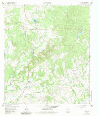
Carlos and Piedmont anchor this mid-century survey of the Grimes County landscape, captured just as the region began a period of hydrological transformation. The map reveals a transition from traditional land use to resource extraction, with multiple Quarries and a Gravel Pit scattered across the terrain. Remnants of earlier infrastructure are clearly visible, including an Old Railroad Grade and a newer Pipeline cutting through the wooded hills. Waterways like Gibbons Creek and Peach Creek wind through the topography, which includes areas designated as subject to controlled inundation. Local heritage is preserved through the mapping of small community hubs, such as Blue Lake Ch and Anderson Grove Ch, alongside several family and community burial grounds including Allen Cem, Renford Cem, and Six Flock Cem. A small Airstrip near the center of the sheet reflects the evolving transit needs of this rural Texas corridor.
Find a feature on this map
28 named features on this map. Tap any name to fly to it.
Don’t see what you’re looking for? This feature index may not catch every label — zoom into the map to look around manually.
Map Details
Editions of this 1960 Carlos Map
4 editions found
Other maps of this area

1913 · Millican
USGS Topo · 1:31,680

1914 · Navasota
USGS Topo · 1:62,500

1954 · Beaumont
USGS Topo · 1:250,000

1954 · Austin
USGS Topo · 1:250,000

1956 · Carlos
USGS Topo · 1:62,500

1957 · Beaumont
USGS Topo · 1:250,000

1958 · Navasota
USGS Topo · 1:24,000

1959 · Millican
USGS Topo · 1:24,000

1959 · Reliance
USGS Topo · 1:24,000

1959 · Ferguson Crossing
USGS Topo · 1:24,000