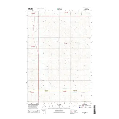
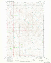
2014 Map of Carlyle NW
USGS Topo · Published 2014About this map
Beaver Cr and its northern tributaries define the drainage patterns of this rural landscape along the boundary of Wibaux and Fallon Counties. The terrain is marked by a network of seasonal watercourses, including Lone Tree Cr, Rattlesnake Cr, and the E Fork Beaver Cr, which flow through the high plains. The area is divided by a series of section lines and range markers such as t11n r60e and t12n r60e, reflecting the organized surveying of the American West. The primary north-south artery, Mt-7, provides the main transit route through the region, connecting a sparse grid of local access roads named for geographic landmarks. These routes, such as Beacon Hill Rd and Edge Hill Rd W, trace the subtle elevations of the prairie, while Rattle Snake Creek Rd follows the winding path of the creek through the central portion of the quadrangle.
Find a feature on this map
57 named features on this map. Tap any name to fly to it.
Don’t see what you’re looking for? This feature index may not catch every label — zoom into the map to look around manually.
Map Details
Editions of this 2014 Carlyle NW Map
This is the sole edition of this map. No revisions or reprints were ever made.
Other maps of this area

1953 · Miles City
USGS Topo · 1:250,000

1957 · Miles City
USGS Topo · 1:250,000

1958 · Miles City
USGS Topo · 1:250,000

1981 · Cap Rock
USGS Topo · 1:24,000
1981 · Shell Butte
USGS Topo · 1:24,000

1981 · Carlyle
USGS Topo · 1:24,000
1981 · Rush Hall Reservoir
USGS Topo · 1:24,000
1981 · Ollie
USGS Topo · 1:24,000
1981 · Carlyle NW
USGS Topo · 1:24,000

1981 · Wibaux
USGS Topo · 1:100,000