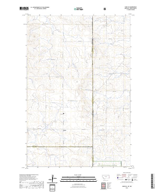
2024 Map of Carlyle
USGS Topo · Published 2024About this map
Carlyle and its surrounding ranchlands sit at the intersection of the Montana North Dakota state line, where the High Plains transition into the rolling breaks of the Little Missouri National Grassland. The landscape is defined by a dense network of intermittent drainage systems, including Lone Tree Creek, Lamesteer Creek, and the East Fork Beaver Creek, which carve out the topography of the Wibaux and Golden Valley county borders.
Find a feature on this map
34 named features on this map. Tap any name to fly to it.
Don’t see what you’re looking for? This feature index may not catch every label — zoom into the map to look around manually.
Map Details
Editions of this 2024 Carlyle Map
This is the sole edition of this map. No revisions or reprints were ever made.
Other maps of this area

1953 · Miles City
USGS Topo · 1:250,000

1953 · Dickinson
USGS Topo · 1:250,000

1957 · Dickinson
USGS Topo · 1:250,000

1957 · Miles City
USGS Topo · 1:250,000

1958 · Miles City
USGS Topo · 1:250,000

1980 · Golva
USGS Topo · 1:24,000

1980 · Thelan
USGS Topo · 1:24,000

1980 · Belfield
USGS Topo · 1:100,000
1981 · Shell Butte
USGS Topo · 1:24,000

1981 · Carlyle
USGS Topo · 1:24,000