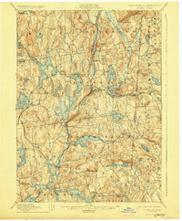
1928 Map of Carmel
USGS Topo · Published 1928About this map
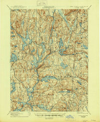
Tilly Foster Mine stands as a industrial landmark within this 1928 edition, centered on the complex hydraulic landscape of Putnam and Westchester counties. Surveyed in cooperation with the N.Y. Aqueduct Commissioners, the map reveals a region defined by its role in New York's water supply system. Reservoirs such as West Branch Reservoir, Croton Falls Reservoir, and Titicus Reservoir dominate the valleys, reshaping the geography around established villages like Carmel and Brewster. A dense network of transportation, including the New York and Harlem RR, connects these lakeside communities and agricultural hamlets. Along the state line, the map detail extends into Connecticut, showing Mill Plain and Ridgefield. The terrain is characterized by numerous natural ponds like Peach Lake and Lake Gleneida, interspersed between the man-made impoundments that fundamentally altered the local drainage patterns of the Muscoot River and its tributaries.
Find a feature on this map
89 named features on this map. Tap any name to fly to it.
Don’t see what you’re looking for? This feature index may not catch every label — zoom into the map to look around manually.
Map Details
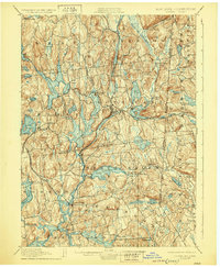
Editions of this 1928 Carmel Map
5 editions found
Other maps of this area

1892 · Stamford
USGS Topo · 1:62,500

1892 · West Point
USGS Topo · 1:62,500

1892 · Danbury
USGS Topo · 1:62,500

1892 · New Milford
USGS Topo · 1:62,500

1892 · Norwalk
USGS Topo · 1:62,500

1892 · Carmel
USGS Topo · 1:62,500

1892 · Tarrytown
USGS Topo · 1:62,500

1893 · Carmel
USGS Topo · 1:62,500

1893 · Stamford
USGS Topo · 1:62,500

1893 · Norwalk
USGS Topo · 1:62,500