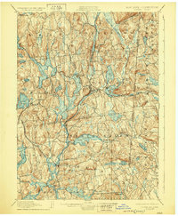
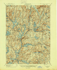
1928 Map of Carmel
USGS Topo · Published 1929About this map
Tilly Foster Mine and the industrial activity of the late 19th century define this landscape, which was surveyed at the end of the 1880s. The region is shaped significantly by the New York City water supply system, featuring a complex network of reservoirs including West Branch Reservoir, Middle Branch Reservoir, and Bog Brook Reservoir. These man-made water bodies intertwine with the natural topography and established villages like Brewster and Carmel, illustrating the transition of Putnam County into a vital watershed for the growing metropolis to the south.
Find a feature on this map
85 named features on this map. Tap any name to fly to it.
Don’t see what you’re looking for? This feature index may not catch every label — zoom into the map to look around manually.
Map Details
Editions of this 1928 Carmel Map
5 editions found
Other maps of this area

1892 · Stamford
USGS Topo · 1:62,500

1892 · West Point
USGS Topo · 1:62,500

1892 · Danbury
USGS Topo · 1:62,500

1892 · New Milford
USGS Topo · 1:62,500

1892 · Norwalk
USGS Topo · 1:62,500

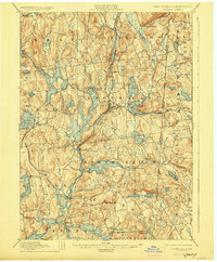
1892 · Carmel
USGS Topo · 1:62,500

1892 · Tarrytown
USGS Topo · 1:62,500

1893 · Carmel
USGS Topo · 1:62,500

1893 · Stamford
USGS Topo · 1:62,500

1893 · Norwalk
USGS Topo · 1:62,500