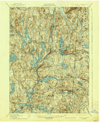
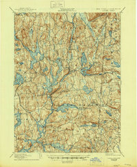
1928 Map of Carmel
USGS Topo · Published 1938About this map
Tilly Foster Mine stands as a prominent industrial landmark in this region, situated just north of Brewster. The landscape is defined by its sophisticated system of water management, with the Croton Falls Reservoir, Middle Branch Reservoir, and Muscoot Reservoir dominating the terrain to support the growing needs of the metropolitan area to the south. The intersection of the New York and Northern RR and the New York and New England RR at Brewster highlights the importance of this area as a transportation hub during the late 19th and early 20th centuries.
Find a feature on this map
86 named features on this map. Tap any name to fly to it.
Don’t see what you’re looking for? This feature index may not catch every label — zoom into the map to look around manually.
Map Details
Editions of this 1928 Carmel Map
5 editions found
Other maps of this area

1892 · Stamford
USGS Topo · 1:62,500

1892 · West Point
USGS Topo · 1:62,500

1892 · Danbury
USGS Topo · 1:62,500

1892 · New Milford
USGS Topo · 1:62,500

1892 · Norwalk
USGS Topo · 1:62,500

1892 · Carmel
USGS Topo · 1:62,500

1892 · Tarrytown
USGS Topo · 1:62,500

1893 · Carmel
USGS Topo · 1:62,500

1893 · Stamford
USGS Topo · 1:62,500

1893 · Norwalk
USGS Topo · 1:62,500