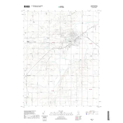
2018 Map of Carmi
USGS Topo · Published 2018About this map
The Little Wabash River winds through the heart of White County, anchoring the regional landscape and the development of Carmi. This survey reveals a dense concentration of local heritage sites, particularly around the city center where The Old Graveyard and Dawn of Ages Memorial Park reside. The surrounding rural townships are characterized by a high frequency of family-named burial grounds, such as the Newman Family Cem, Saunders Family Cem, and Holderby Family Cem, which serve as vital markers for genealogical research. Transportation patterns are defined by the grid of county roads and the rail line passing through Bingman Station. To the south, the terrain follows the meanders of Grindstone Cr and Elanders Cr, while numerous small lakes like Absher Lake and Griffith Lake dot the lowlands adjacent to the river.
Find a feature on this map
116 named features on this map. Tap any name to fly to it.
Don’t see what you’re looking for? This feature index may not catch every label — zoom into the map to look around manually.
Map Details
Editions of this 2018 Carmi Map
This is the sole edition of this map. No revisions or reprints were ever made.
Other maps of this area

1905 · Eldorado
USGS Topo · 1:62,500

1905 · New Haven
USGS Topo · 1:62,500

1906 · New Haven
USGS Topo · 1:62,500

1906 · Eldorado
USGS Topo · 1:62,500

1940 · Carmi
USGS Topo · 1:62,500

1941 · Enfield
USGS Topo · 1:62,500

1943 · Carmi
USGS Topo · 1:62,500

1944 · Enfield
USGS Topo · 1:62,500

1949 · Paducah
USGS Topo · 1:250,000

1949 · New Haven
USGS Topo · 1:62,500