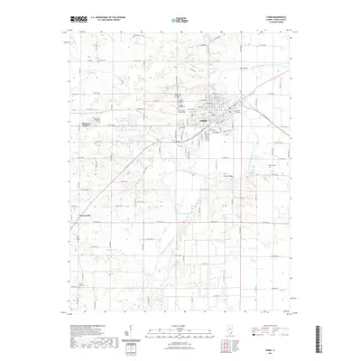
2021 Map of Carmi
USGS Topo · Published 2021About this map
The Little Wabash River winds through the heart of White County, anchoring the city of Carmi and several outlying hamlets. This modern survey reflects a landscape shaped by both its agricultural foundations and its deep-rooted community history, visible in the high density of burial grounds and memorial sites. Significant local landmarks include The Old Graveyard within the city limits and the nearby White County Memorial Gardens. The river's influence on local geography is marked by crossings such as Lowe Bridge and Possum Bridge, as well as numerous oxbows and feeder streams like Flanders Creek and Grindstone Creek. To the west, the settlements of Brownsville and Bingman Station are situated among a network of rural roads, while the terrain rises toward Eaton Hill and Big Hill, providing a varied topography north of the river's main channel.
Find a feature on this map
114 named features on this map. Tap any name to fly to it.
Don’t see what you’re looking for? This feature index may not catch every label — zoom into the map to look around manually.
Map Details
Editions of this 2021 Carmi Map
This is the sole edition of this map. No revisions or reprints were ever made.
Other maps of this area

1905 · Eldorado
USGS Topo · 1:62,500

1905 · New Haven
USGS Topo · 1:62,500

1906 · New Haven
USGS Topo · 1:62,500

1906 · Eldorado
USGS Topo · 1:62,500

1940 · Carmi
USGS Topo · 1:62,500

1941 · Enfield
USGS Topo · 1:62,500

1943 · Carmi
USGS Topo · 1:62,500

1944 · Enfield
USGS Topo · 1:62,500

1949 · Paducah
USGS Topo · 1:250,000

1949 · New Haven
USGS Topo · 1:62,500