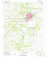
1974 Map of Carmi
USGS Topo · Published 1977About this map
The Little Wabash River meanders past the seat of White County in the mid-1970s, where the convergence of the Louisville and Nashville and Penn Central railroads once anchored the local economy. Beyond the street grid of Carmi, the landscape transitions into the productive Heralds Prairie, a region defined by agricultural plots and active petroleum extraction. Numerous oil operations, including the Carmi Oil Field and the Roland Oil Field, are marked alongside a network of rural churches and cemeteries. Historical research is supported by the identification of localized sites such as Bingman Station, St Polycarp Cem, and the Brownsville Sch. The presence of several distinct burial grounds, from The Old Graveyard to Sumpter Cem, provides a detailed record of the community's early settlement patterns and family heritage.
Find a feature on this map
70 named features on this map. Tap any name to fly to it.
Don’t see what you’re looking for? This feature index may not catch every label — zoom into the map to look around manually.
Map Details
Editions of this 1974 Carmi Map
This is the sole edition of this map. No revisions or reprints were ever made.
Other maps of this area

1905 · Eldorado
USGS Topo · 1:62,500

1905 · New Haven
USGS Topo · 1:62,500

1906 · New Haven
USGS Topo · 1:62,500

1906 · Eldorado
USGS Topo · 1:62,500

1940 · Carmi
USGS Topo · 1:62,500

1941 · Enfield
USGS Topo · 1:62,500

1943 · Carmi
USGS Topo · 1:62,500

1944 · Enfield
USGS Topo · 1:62,500

1949 · Paducah
USGS Topo · 1:250,000

1949 · New Haven
USGS Topo · 1:62,500