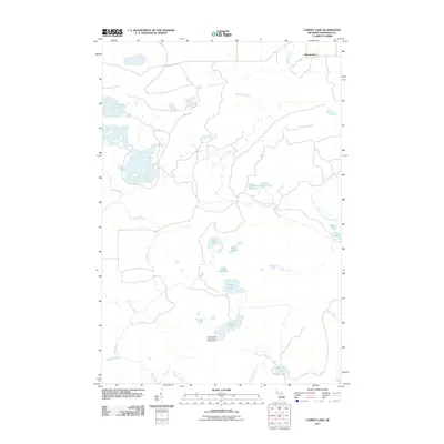
2011 Map of Carney Lake
USGS Topo · Published 2011About this map
Metropolitan stands as a primary point of reference in this Upper Peninsula landscape, situated near the northern reaches of the West Branch Sturgeon River. The terrain is defined by a dense network of small lakes and seasonal drainage systems, reflecting the glaciated topography of Dickinson County. Public access to the outdoors is anchored by the Carney Lake State Forest Campground on the shores of Carney Lake, while smaller water bodies like Crystal Lake, Little Crystal Lake, and Benton Lake are scattered throughout the interior. Numerous creeks, including Mitchell Creek, Seiberts Creek, and Pine Creek, carve through the region, illustrating the intricate watershed that feeds into the larger river systems of the north woods.
Find a feature on this map
19 named features on this map. Tap any name to fly to it.
Don’t see what you’re looking for? This feature index may not catch every label — zoom into the map to look around manually.
Map Details
Editions of this 2011 Carney Lake Map
This is the sole edition of this map. No revisions or reprints were ever made.
Other maps of this area

1899 · Sagola
USGS Topo · 1:62,500

1939 · Iron Mountain
USGS Topo · 1:48,000

1941 · Iron Mountain
USGS Topo · 1:48,000

1947 · Iron Mountain
USGS Topo · 1:48,000

1954 · Iron Mountain
USGS Topo · 1:250,000

1954 · Escanaba
USGS Topo · 1:250,000

1955 · Norway
USGS Topo · 1:24,000

1955 · Vulcan
USGS Topo · 1:24,000

1955 · Norway
USGS Topo · 1:62,500
1955 · Randville
USGS Topo · 1:24,000