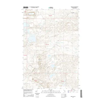
2014 Map of Carney Lake
USGS Topo · Published 2014About this map
Metropolitan stands as the primary settlement on this Upper Peninsula landscape, situated near the northern reaches of the W Br Sturgeon River. The terrain is defined by an intricate network of waterways and glacial depressions, including significant water bodies such as Carney Lake and Rock Lake. These natural features dictated the early layout of regional transit, as seen in the routes of Metropolitan Rd and Carney Lake Rd.
Find a feature on this map
44 named features on this map. Tap any name to fly to it.
Don’t see what you’re looking for? This feature index may not catch every label — zoom into the map to look around manually.
Map Details
Editions of this 2014 Carney Lake Map
This is the sole edition of this map. No revisions or reprints were ever made.
Other maps of this area

1899 · Sagola
USGS Topo · 1:62,500

1939 · Iron Mountain
USGS Topo · 1:48,000

1941 · Iron Mountain
USGS Topo · 1:48,000

1947 · Iron Mountain
USGS Topo · 1:48,000

1954 · Iron Mountain
USGS Topo · 1:250,000

1954 · Escanaba
USGS Topo · 1:250,000

1955 · Norway
USGS Topo · 1:24,000

1955 · Vulcan
USGS Topo · 1:24,000

1955 · Norway
USGS Topo · 1:62,500
1955 · Randville
USGS Topo · 1:24,000