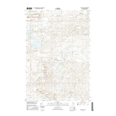
2017 Map of Carney Lake
USGS Topo · Published 2017About this map
Metropolitan sits in the northeast corner of this Michigan landscape, a region defined by a high density of glacial lakes and technical timber access routes. The W Br Sturgeon River winds through the northern sections, while the drainage network of Mitchell Cr and Pine Cr connects numerous water bodies like Crystal Lake and Moon Lake. The infrastructure of the area reflects both its industrial past and recreational present. Roads such as Groveland Mine Rd and Calumet Mine Rd point to the historic iron mining heritage of Dickinson County, while the extensive Merriman Ski Trail system demonstrates the more modern conversion of the landscape for outdoor use. Water resources are central here, with Carney Lake and its associated Carney Lake Outlet anchoring the southern half of the quadrangle.
Find a feature on this map
47 named features on this map. Tap any name to fly to it.
Don’t see what you’re looking for? This feature index may not catch every label — zoom into the map to look around manually.
Map Details
Editions of this 2017 Carney Lake Map
This is the sole edition of this map. No revisions or reprints were ever made.
Other maps of this area

1899 · Sagola
USGS Topo · 1:62,500

1939 · Iron Mountain
USGS Topo · 1:48,000

1941 · Iron Mountain
USGS Topo · 1:48,000

1947 · Iron Mountain
USGS Topo · 1:48,000

1954 · Iron Mountain
USGS Topo · 1:250,000

1954 · Escanaba
USGS Topo · 1:250,000

1955 · Norway
USGS Topo · 1:24,000

1955 · Vulcan
USGS Topo · 1:24,000

1955 · Norway
USGS Topo · 1:62,500
1955 · Randville
USGS Topo · 1:24,000