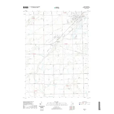
2019 Map of Caro
USGS Topo · Published 2019About this map
The Tuscola County Courthouse stands as the central landmark of Caro, the county seat of Tuscola County, situated along the banks of the Cass River. This agricultural landscape is defined by an intricate network of drainage systems, including the Applegate Drain, Coleman Drain, and Chambers Drain, which facilitate the productivity of the surrounding Thumb region farmlands. To the southwest, the small settlement of Wahjamega occupies a bend in the river, adjacent to the Wahjamega Cem. For genealogists, the map identifies several distinct burial grounds scattered across the townships, such as Sacred Heart Catholic Cem, Moreland Cem, and North Grove Cem. The area’s aviation infrastructure is represented by the Tuscola Area Airport, located between the primary residential centers. The map's grid-based road system, featuring routes like W Caro Rd and Center Rd, reflects the organized settlement patterns typical of Michigan's interior.
Find a feature on this map
67 named features on this map. Tap any name to fly to it.
Don’t see what you’re looking for? This feature index may not catch every label — zoom into the map to look around manually.
Map Details
Editions of this 2019 Caro Map
This is the sole edition of this map. No revisions or reprints were ever made.
Other maps of this area

1954 · Flint
USGS Topo · 1:250,000

1958 · Flint
USGS Topo · 1:250,000

1963 · East Dayton
USGS Topo · 1:24,000

1963 · Mayville
USGS Topo · 1:24,000

1963 · Fairgrove
USGS Topo · 1:24,000

1963 · Ellington
USGS Topo · 1:24,000

1963 · Gilford
USGS Topo · 1:24,000

1963 · Caro
USGS Topo · 1:24,000

1963 · Vassar
USGS Topo · 1:24,000

1963 · Juniata
USGS Topo · 1:24,000