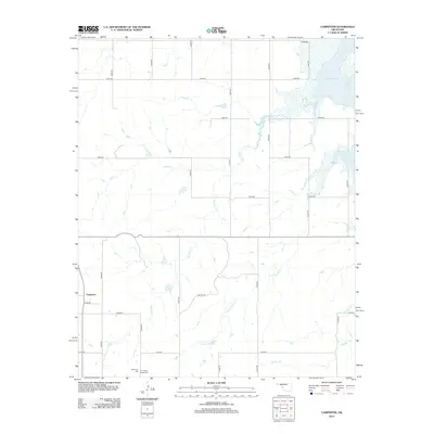
2012 Map of Carpenter
USGS Topo · Published 2012About this map
Carpenter stands as a small community node in Roger Mills County, Oklahoma, positioned in a landscape defined by an extensive network of drainage creeks and rural section-line roads. The southern portion of the map is home to the Thompson Cem and Thompson Pixlee Cem, which provide significant local genealogical interest for those tracing early families in this part of western Oklahoma. This 2012 survey illustrates the hydrological reach of the Foss Reservoir in the northeast corner, where the waters back up into local tributaries.
Find a feature on this map
26 named features on this map. Tap any name to fly to it.
Don’t see what you’re looking for? This feature index may not catch every label — zoom into the map to look around manually.
Map Details
Editions of this 2012 Carpenter Map
This is the sole edition of this map. No revisions or reprints were ever made.
Other maps of this area

1955 · Clinton
USGS Topo · 1:250,000

1957 · Clinton
USGS Topo · 1:250,000

1957 · Butler
USGS Topo · 1:62,500

1957 · Dill City
USGS Topo · 1:62,500

1960 · Hammon
USGS Topo · 1:62,500

1961 · Elk City
USGS Topo · 1:62,500

1976 · Butler NW
USGS Topo · 1:24,000

1976 · Butler SW
USGS Topo · 1:24,000

1976 · Dill City NE
USGS Topo · 1:24,000
1983 · Foss Dam
USGS Topo · 1:24,000