
1944 Map of Carrabelle
USGS Topo · Published 1944About this map
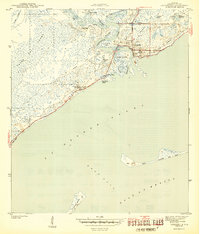
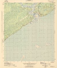
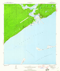
The town of Carrabelle serves as the focal point of this coastal survey, where the Carrabelle River flows into St George Sound. Surveyed in 1943, the map captures a significant maritime and industrial landscape defined by the confluence of the New River and Crooked River. To the west, the formidable Tates Hell Swamp dominates the interior, while a solitary Landing Strip and the Carrabelle Lighthouse mark the era's navigational infrastructure. The local economy and transport are further evidenced by the Seaboard Railway corridor and settlements like Yent Place and Davis. Coastal features including Timber Island, Dog Island, and the dunes of St George Island illustrate the intricate barrier system protecting the Florida Panhandle during the mid-forties.
Find a feature on this map
33 named features on this map. Tap any name to fly to it.
Don’t see what you’re looking for? This feature index may not catch every label — zoom into the map to look around manually.
Map Details
Editions of this 1944 Carrabelle Map
4 editions found
Other maps of this area

1943 · Dog Island
USGS Topo · 1:31,680

1943 · Carrabelle
USGS Topo · 1:24,000

1944 · Pickett Bay
USGS Topo · 1:31,680

1944 · Green Point
USGS Topo · 1:31,680

1944 · Sugar Hill
USGS Topo · 1:31,680

1945 · Tates Hell Swamp
USGS Topo · 1:31,680

1945 · Mc Intyre
USGS Topo · 1:31,680

1945 · Sugar Hill
USGS Topo · 1:31,680

1945 · Pickett Bay
USGS Topo · 1:31,680

1949 · Apalachicola
USGS Topo · 1:250,000