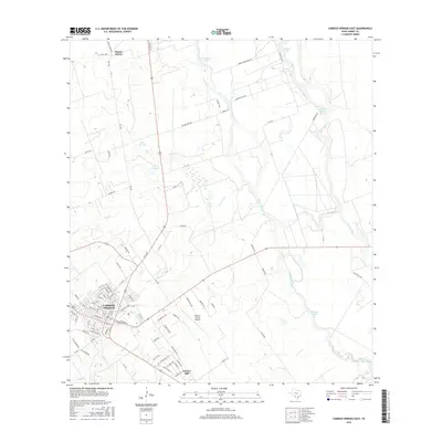
2016 Map of Carrizo Springs East
USGS Topo · Published 2016About this map
Carrizo Springs serves as the focal point of this South Texas landscape, where the urban grid meets the agricultural and riparian corridors of Dimmit County. The map details the transition from the residential streets of English Street and Eaton Street to the surrounding ranchlands and water systems. To the north, Winter Haven sits near the shores of Espantosa Lake, while the eastern portion of the quadrangle is defined by the winding course of the Nueces River and its associated wetlands, including Line Oak Slough and Soldier Slough.
Find a feature on this map
91 named features on this map. Tap any name to fly to it.
Don’t see what you’re looking for? This feature index may not catch every label — zoom into the map to look around manually.
Map Details
Editions of this 2016 Carrizo Springs East Map
This is the sole edition of this map. No revisions or reprints were ever made.
Other maps of this area

1929 · Cotulla
USGS Topo · 1:125,000

1932 · Valley Wells
USGS Topo · 1:62,500

1939 · Carrizo Springs
USGS Topo · 1:62,500

1939 · Big Wells
USGS Topo · 1:62,500

1940 · Asherton
USGS Topo · 1:62,500

1940 · Catarina
USGS Topo · 1:62,500

1953 · Crystal City
USGS Topo · 1:250,000

1955 · Crystal City
USGS Topo · 1:250,000

1961 · Crystal City
USGS Topo · 1:250,000

1968 · Crystal City
USGS Topo · 1:250,000